Rendered from /layouts/papers/single.html
Coverage-Maximizing Solar-Powered Autonomous Surface Vehicle Control for Persistent Gulf Stream Observation
Abstract
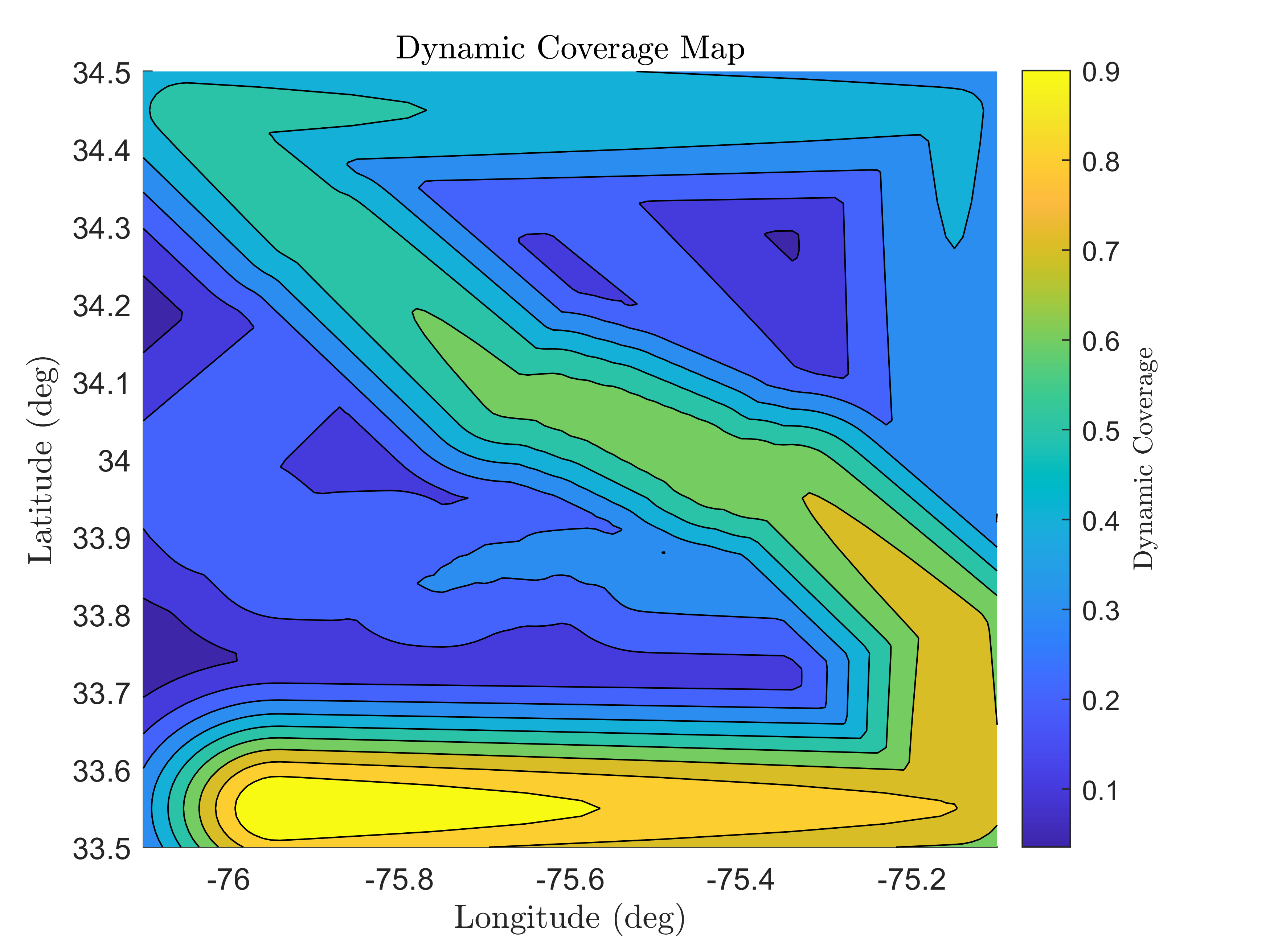
The Gulf Stream, which comes within 100 km of the United States coastline in both the Florida Straits and the vicinity of Cape Hatteras, is estimated to possess over 160 TWh/year of technical energy capacity. To better understand the behavior of the Gulf Stream, whose flow resource varies in both space and time, a relatively sparse network of fixed acoustic Doppler current profilers (ADCPs) and shore-mounted high-frequency radar units have been supplemented by more granular but infrequent boat transect runs and undersea glider deployments. Collectively, these measurements provide highly granular data with respect to either time or space, but not both. This work represents part of a comprehensive effort to evaluate use of a solar-powered autonomous surface vehicle (ASV) fleet to supplement existing observational capabilities. The proposed solar-powered ASV can provide data with high spatial and temporal granularity, but comes with the challenge of optimally planning its mission in an adaptive manner. To address this challenge in this work, we propose a multilevel controller that fuses the A* search algorithm with an upper level waypoint selector and lower level heading control. Focusing on a critically important mission domain adjacent to Cape Hatteras, and relying on a Mid-Atlantic Bight, South Atlantic Bight Regional Ocean Model (MAB-SAB-ROM), we compare the performance of our proposed algorithm against several competing strategies. We demonstrate a significant performance improvement in terms of a dynamic coverage metric, both in comparison to competing strategies and to the existing observational network.